TAC-100 Underwater Navigation Board is the navigation standard for military divers worldwide. It is a compact, durable and reliable platform that allows special operations divers to navigate accurately underwater where visibility is limited and GPS signals are unavailable. Below is a detailed technical description of this tool, its applications and training specifics.
Functions and design
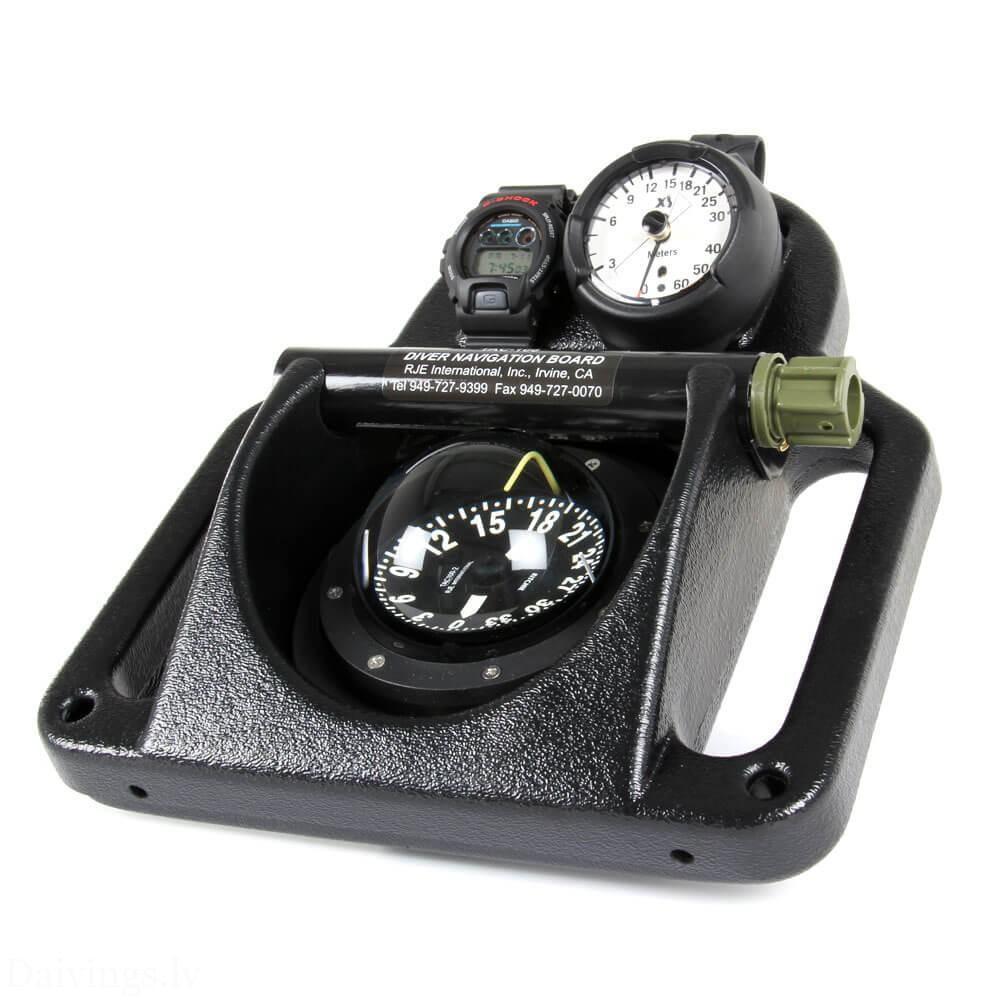
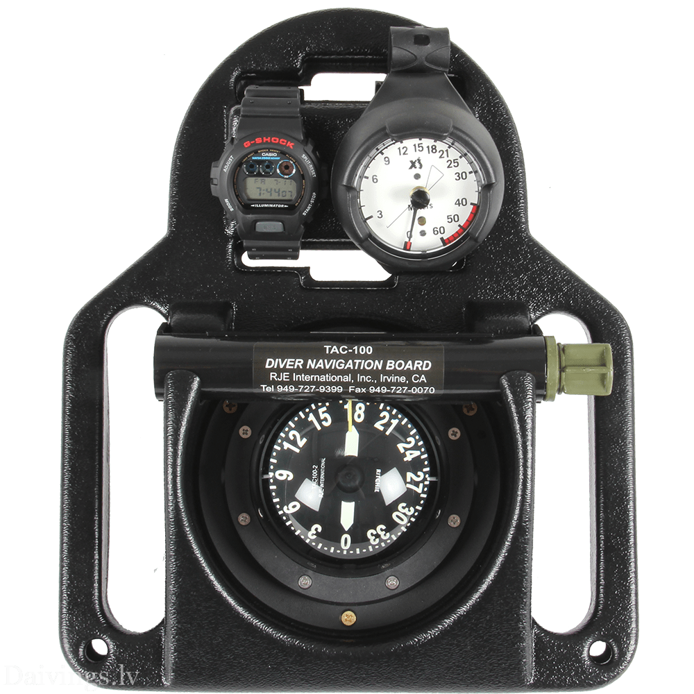
The TAC-100 is not just a board; it is an integrated navigation system, with every element playing a critical role.
- The Board: Made of high density, black ABS plastic or polycarbonate, it has a slight negative or neutral buoyancy, which provides stability when held in both hands.
- Magnetic compass (TAC100-2): The main element. It is liquid-filled, has a large, easy-to-read dial, and luminescent markings for night operations.
- Digital depth gauge and stopwatch: There is space on the board for an electronic depth gauge that shows the current depth and dive time. Time is a critical variable for calculating distance traveled.
- Buoyancy control: Ergonomic handles on both sides allow the diver to hold the board directly in front of them at eye level, ensuring the compass is in a horizontal position for accurate readings.
Meaning and tasks
In modern warfare, underwater navigation is the key to “stealth.” The TAC-100’s primary missions are:
- Infiltration: Getting from a base ship or point of departure to a target object (e.g., an enemy port) without surfacing.
- Mine search and destruction: Accurate square searching using course and time tracking.
- Survey of objects: Searching ship hulls or underwater infrastructure.
- Extraction: Safe return to the collection point after completing the task.
Training and methodology
Training with the TAC-100 begins in the pool and gradually moves to open water with zero visibility. The main methodology is based on Dead Reckoning (DR) principle.
Distance measurement (Leg stroke counting)
Divers need to know their personal “speed.”
- During training, the time or kicks needed to swim are measured. 30 meters or 100 meters.
- Knowing his average speed, the diver can calculate the distance:$$Distance = Speed \times Time$$
Staying on course
"Triangulation" and underwater course changes (e.g., swimming in an "L" or "Z" shape) are practiced, maintaining accuracy of up to 1-2 degrees.
Demo Mission: “Silent Anchor”
Purpose: Conduct covert infiltration and place a mock mine on the anchor chain of the target ship.
Mission parameters:
- Drop-off point: 400 meters from the shoreline.
- Purpose: Port Pier No. 4.
- Depth: 6-8 meters.
- Navigation plan:
| Stage | Course (Azimuth) | Distance/Time | Task |
| Stage 1 | 045° | 150 meters (about 5 min) | Infiltration from the drop-off point |
| Stage 2 | 090° | 100 meters (about 3 min) | Avoiding Coast Patrol Sensors |
| Stage 3 | 010° | 150 meters (to the target) | Approaching the target ship |
| Stage 4 | 190° | Return | Extraction after mine installation |
Execution progress:
- Pre-dive check: The Point Man sets the compass to 045°. The Buddy checks the stopwatch.
- Diving: Upon reaching a depth of 6 meters, the divers assume a horizontal position. Point Man holds the TAC-100 and focuses solely on the course.
- Control: Every 50 meters, the partner confirms the depth and air consumption with a hand signal.
- Goal achievement: Upon reaching the target distance (by time/waves), the team performs a visual identification. If visibility is 0, a feeler or sonar is used.
- Demining/mining the object: After completing the task, the board is turned 180° (return course), and the team heads to the evacuation area.
Important note: The effectiveness of the TAC-100 is directly dependent on the diver's ability to remain calm and maintain a constant swimming pace. Any panic or rapid movement will shift the compass, which can cause a deviation of up to 50 meters from the target at a distance of 500 meters.