Company "Dronelab” offers underwater bottom survey services with autonomous, programmable underwater vehicles
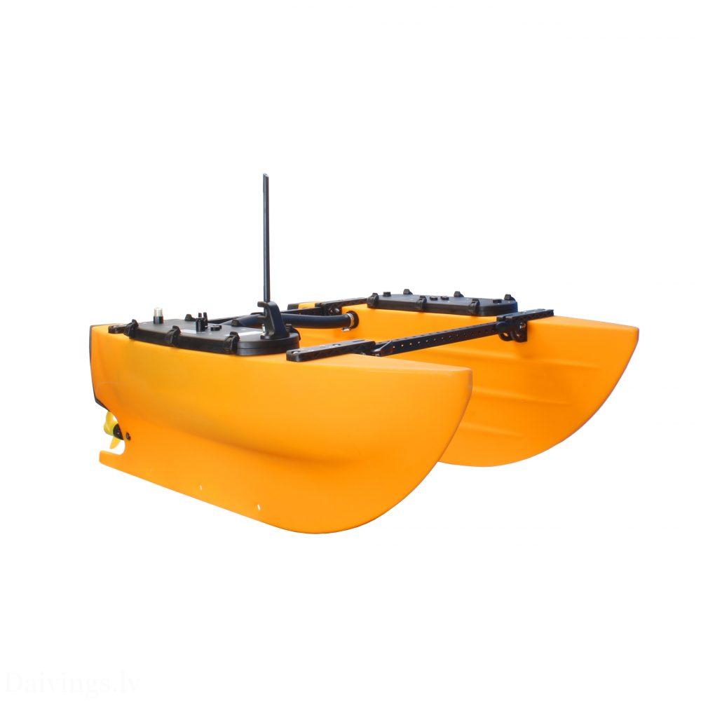
Company "Dronelab"offers modern underwater survey and mapping services using remotely controlled autonomous surface vehicles (ASVs). Our services are provided in Latvian territorial waters, inland waters (lakes, rivers) and elsewhere in the Baltic Sea region.
The APs created by the company are equipped with high-resolution sensor systems, including:
- Side scan sonar (SSS): For obtaining detailed acoustic images of the underwater bed.
- Multibeam echo sounder (DE): For precise bathymetry (depth) mapping and bed relief representation.
- Depth gauge (DM): For quick depth information acquisition.
These technologies provide high-quality data and detailed images of the underwater environment, which are essential in various fields – from infrastructure development to environmental protection and security.
Service description
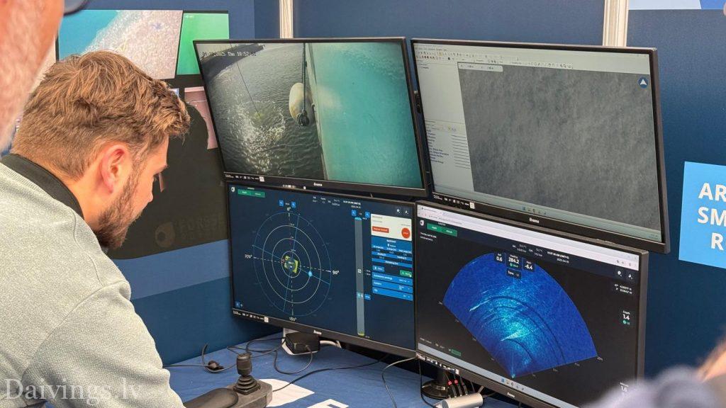
Our work uses modern autonomous surface vehicles (ASVs) equipped with specialized high-resolution sensors. The vehicles autonomously move along pre-planned routes, continuously collecting data about the waterbed and objects in it. The acquired data (e.g. from SSS or DE) allows us to generate detailed acoustic images and bathymetric maps that accurately reflect underwater topography, sediment types, and various natural and man-made objects.
Advantages of autonomous watercraft:
- Long-lasting action: APs are able to operate continuously for longer periods than traditional manned vessels, providing wider coverage of territory in a single mission and reducing downtime.
- Increased security: Since there is no crew on board, the AP can safely perform tasks in potentially dangerous areas (e.g., with unexploded ordnance, in difficult hydrometeorological conditions).
- Reduced costs: AP operation is more economically efficient due to lower fuel consumption (especially electric/hybrid models), optimized logistics and cost savings on crew.
- High data quality: The AP is able to accurately maintain a set course and speed, ensuring stable conditions for sensor operation and obtaining uniform, high-precision data.
- More environmentally friendly: Many AP models use electric or hybrid drive systems, significantly reducing emissions and impact on the aquatic environment.
Sensor capabilities (e.g. SSS, DE):
- High resolution images and maps: SSS provides detailed acoustic images of the underwater bed, while DE allows for the creation of accurate 3D bathymetric maps, revealing even small objects and subtle changes in the bed structure.
- Surveying a wide area: Depending on the technology used, frequency, and scan width, large areas of water can be surveyed quickly and efficiently.
- Underwater object detection: The data obtained clearly identifies sunken ships, their parts, pipelines, cables, rocks, anchors, as well as other natural or artificial structures and anomalies.
- Bearing characterization: By analyzing the reflected acoustic signal (especially SSS and DE data), it is possible to map different sediment types and identify distinct benthic habitats.
Areas of application in Latvia and the Baltic Sea:
- Development and maintenance of offshore wind farms: Detailed bed survey and mapping prior to construction, assessment of support structure (foundation) installation locations, cable routing and regular inspection of underwater infrastructure.
- Pipeline and cable surveys: Precise determination of underwater communication (cable, pipeline) routes, monitoring of their technical condition, identification of potential damage or open sections in the exclusive economic zone and territorial waters of Latvia.
- Environmental monitoring: Mapping and determining the distribution of benthic habitats, indirect identification of pollution sources (based on bed changes) and assessment of the impact of human activity in Latvian coastal waters, as well as in inland waters (lakes, rivers, reservoirs).
- Hydrographic mapping and navigation safety: Obtaining accurate bathymetric data, identifying navigational hazards and underwater objects to ensure safe navigation in Latvian waters, port areas and shipping lanes.
- Search and rescue operations: Fast and efficient localization of sunken objects (e.g. shipwrecks, vehicles) in case of accidents at sea or in inland waters.
- Underwater archaeology: Discovery, mapping and non-invasive exploration of underwater cultural heritage sites (e.g., historic shipwrecks, ancient sites).
- Security and monitoring: Monitoring of strategically important underwater infrastructure, detecting signs of unauthorized activity and improving surveillance capabilities of the general maritime space.
The company's services include:
- Consultations on choosing the most appropriate survey strategy and technology for your needs.
- Mission planning, preparation, deployment and management of AP systems.
- High-quality underwater data acquisition using SSS, DE, DM or other necessary sensor systems.
- Processing and analysis of the obtained data using specialized software.
- Preparation of detailed reports, maps (e.g. bathymetry, bed structure, feature maps) and visualizations in accordance with client requirements and international standards.
Contact Dronelab!
To learn more about our autonomous watercraft services and receive a personalized offer for your underwater survey projects in Latvia and the Baltic Sea, please contact us via contact formWe are ready to provide efficient and high-quality solutions for your specific needs.